var breeze_prefetch = {"local_url":"https:\/\/avpay.aero","ignore_remote_prefetch":"1","ignore_list":["\/cart-2\/","\/checkout\/","\/my-account\/","\/cart-2\/","\/checkout\/","\/wp-admin\/"]};
var _wpUtilSettings = {"ajax":{"url":"\/wp-admin\/admin-ajax.php"}};
https://avpay.aero/wp-includes/js/wp-util.min.js
var wc_add_to_cart_params = {"ajax_url":"\/wp-admin\/admin-ajax.php","wc_ajax_url":"\/?wc-ajax=%%endpoint%%","i18n_view_cart":"View cart","cart_url":"https:\/\/avpay.aero\/cart-2\/","is_cart":"","cart_redirect_after_add":"no"};
var wc_add_to_cart_variation_params = {"wc_ajax_url":"\/?wc-ajax=%%endpoint%%","i18n_no_matching_variations_text":"Sorry, no products matched your selection. Please choose a different combination.","i18n_make_a_selection_text":"Please select some product options before adding this product to your cart.","i18n_unavailable_text":"Sorry, this product is unavailable. Please choose a different combination."};
var cmplz_tcf = {"cmp_url":"https:\/\/avpay.aero\/wp-content\/uploads\/complianz\/","retention_string":"Retention in days","undeclared_string":"Not declared","isServiceSpecific":"1","excludedVendors":{"15":15,"46":46,"56":56,"66":66,"110":110,"119":119,"139":139,"141":141,"174":174,"192":192,"261":261,"262":262,"359":359,"375":375,"377":377,"387":387,"415":415,"427":427,"431":431,"435":435,"458":458,"462":462,"482":482,"508":508,"512":512,"521":521,"527":527,"528":528,"531":531,"544":544,"569":569,"581":581,"587":587,"626":626,"644":644,"667":667,"711":711,"713":713,"733":733,"734":734,"736":736,"748":748,"756":756,"776":776,"786":786,"806":806,"809":809,"822":822,"836":836,"856":856,"870":870,"873":873,"876":876,"879":879,"882":882,"888":888,"890":890,"894":894,"899":899,"908":908,"909":909,"923":923,"970":970,"975":975,"986":986,"988":988,"996":996,"1011":1011,"1015":1015,"1018":1018,"1022":1022,"1039":1039,"1044":1044,"1051":1051,"1075":1075,"1078":1078,"1079":1079,"1087":1087,"1094":1094,"1102":1102,"1107":1107,"1114":1114,"1115":1115,"1121":1121,"1123":1123,"1124":1124,"1139":1139,"1141":1141,"1149":1149,"1156":1156,"1164":1164,"1167":1167,"1173":1173,"1181":1181,"901":901,"1198":1198,"1199":1199,"1211":1211,"1216":1216},"purposes":[1,2,3,4,5,6,7,8,9,10,11,1],"specialPurposes":[1,2],"features":[1,2,3],"specialFeatures":[1,2],"publisherCountryCode":"GB","lspact":"N","ccpa_applies":"","ac_mode":"1","debug":"","prefix":"cmplz_"};
var woopack_config = {"ajaxurl":"https:\/\/avpay.aero\/wp-admin\/admin-ajax.php","page":0,"current_page":"https:\/\/avpay.aero\/rocketmine\/drone-news-articles\/african-gold-mine-search-rescue-operation\/","woo_url":"https:\/\/avpay.aero\/wp-content\/plugins\/woocommerce\/"};
( function() {
window.onpageshow = function( event ) {
// Defined window.wpforms means that a form exists on a page.
// If so and back/forward button has been clicked,
// force reload a page to prevent the submit button state stuck.
if ( typeof window.wpforms !== 'undefined' && event.persisted ) {
window.location.reload();
}
};
}() );
In May 2021, a critical incident at an African gold mine saw the managing director urgently seeking external assistance with a search & rescue operation.
One of the largest & oldest gold mines in the world had recently begun re-mining. With establishment phases complete, the mine was fully productive when suspected pillar failure caused a ground collapse in one of the smaller mining stopes.
When the crisis hit, rescue teams sprang into action, conducting exhaustive searches of the accessible areas over a period of days. As they advanced, increasingly difficult conditions underground meant that the standard search procedures were proving fruitless. With uncertainty about the stability of the search area heightening the risk to rescue teams, & with one contractor missing, the company sought a technological solution.
The chief surveyor & managing director immediately reached out to the two major drone operators in the region. The mine in question had previously been introduced to Rocketmine’s capabilities during a road show & were hopeful that the company’s assets & expertise could assist & augment the human search & rescue operation.
Rocketmine solution
Rocketmine’s Eric Delabrousse was in Johannesburg when he received the first of a long line of outreach calls from the mine’s chief surveyor & managing director.
After learning that the closest drone was in the U.S. & potentially weeks away from availability, the surveyor made clear the critical nature of the scenario & the complexity of the mine’s environment, which runs to a depth of 1500m & has shafts & a single access decline with interlevel development of between 15 & 30 metres.
Delabrousse Immediately Set The Wheels In Motion To Expedite Bringing The Technology To The Mine’s Aid.
Coordinating the logistics of dealing with numerous stakeholders – l& & air transport, courier pick-ups & delivery – thirty-six hours later, both the Rocketmine operator & drone were in-situ & ready to begin flying into inaccessible areas.
A second underground mapping operator engaged by the mine arrived on site but was unable to configure their drone & provide support.
Thus, over the next two weeks, it was up to Rocketmine to scrutinize the site, identify safe zones for flying & pick up where the search & rescue crews had left off.
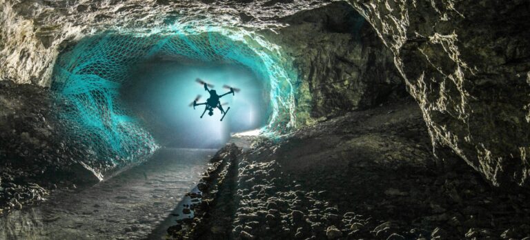
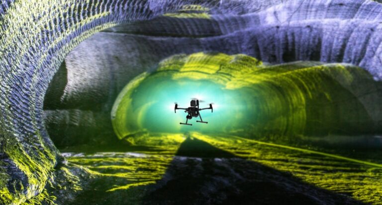
Rocketmine flew their drone every day using intelligent LiDAR laser collision avoidance technology to provide eyes on the problem within the no-go zone & GPS denied environment.
This radical AI technology provided crucial detail to surface crews; helping to assess the impact of the collapse without further risk to life. Additionally, the speed & clarity of their image & data gathering meant the mine’s survey & geotechnical departments were fully informed at each step of the operation.
In particular, the scans provided by Rocketmine provided the following outcomes:
Accurately measured the nature, extent & volume of the void created by the subsidence.
Revealed other already-existent voids in that area that were not captured by previous CMS scans.
Accurately captured the multiple ground movements which continued to occur during the daily scans.
Provided the data which enabled the excavation of the failed material & its impact on the subsidence area (void), which eventually led to the discovery of the missing contractor.
Upon Conclusion Of The Operation, The Mine Noted The Professional & Efficient Action Of Rocketmine; In Particular, The Success Of Both Operator & Technology In Delivering Outcomes.
Industry Challenge
While it is a given that mining remains a high-risk working environment, technology now exists to dramatically improve the safety of employees & operations. This case study illustrates the power of drone technology, not only in increasing safety, but also in diminishing the huge impact of losses, & potentially weeks or even months of lost productivity, in the wake of critical incidents.
Historically, the mining industry has made enormous advances in risk reduction & promoting safety awareness; most recently by investing heavily in autonomous machinery & computerised equipment. Rapid response protocols & procedures are vital in supporting any human activity on mine sites & it is crucial that mine owners keep abreast of the technology which can support this. However, simply purchasing expensive equipment is not the silver bullet.
As demonstrated by Rocketmine in this scenario, the AI technology is valuable & accessible. With mine sites expanding & more re-working of older mines, automated mapping & monitoring areas of concern is critical.
Rocketmine’s Use Of Drones Equipped With Lidar Laser Technology Allows Underground Scanning Capacity, Which Delivers Rapid, Accurate Information To Geotechnical & Survey Departments.
The outputs & benefits of this process include:
Extent & volume of void (mined-out area).
QA/QC on blasting activities (overbreak, underbreak).
Monitoring & advising on safety of mining activities (open holes & voids around excavation areas).
Monitoring of mining pillars, stope stability, slopes & highwalls.
Monitoring condition of ground & support systems.
Monitoring rock mass movement & failure prediction.
Using underground mapping technology to safely capture data & footage from inaccessible areas can enable quick, actionable responses to save lives & mitigate the impact of prolonged, expensive closures.
Achieving this winning formula relies on engaging a team whose knowledge of the drone technology, combined with professional expertise, maximises outcomes & helps anticipate & avoid costly problems.
To provide the best experiences, we and our partners use technologies like cookies to store and/or access device information. Consenting to these technologies will allow us and our partners to process personal data such as browsing behavior or unique IDs on this site and show (non-) personalized ads. Not consenting or withdrawing consent, may adversely affect certain features and functions.
Click below to consent to the above or make granular choices. Your choices will be applied to this site only. You can change your settings at any time, including withdrawing your consent, by using the toggles on the Cookie Policy, or by clicking on the manage consent button at the bottom of the screen.
Functional Always active
The technical storage or access is strictly necessary for the legitimate purpose of enabling the use of a specific service explicitly requested by the subscriber or user, or for the sole purpose of carrying out the transmission of a communication over an electronic communications network.
Preferences
The technical storage or access is necessary for the legitimate purpose of storing preferences that are not requested by the subscriber or user.
Statistics
The technical storage or access that is used exclusively for statistical purposes.The technical storage or access that is used exclusively for anonymous statistical purposes. Without a subpoena, voluntary compliance on the part of your Internet Service Provider, or additional records from a third party, information stored or retrieved for this purpose alone cannot usually be used to identify you.
Marketing
The technical storage or access is required to create user profiles to send advertising, or to track the user on a website or across several websites for similar marketing purposes.
To provide the best experiences, we use technologies like cookies to store and/or access device information. Consenting to these technologies will allow us to process data such as browsing behavior or unique IDs on this site. Not consenting or withdrawing consent, may adversely affect certain features and functions.
Functional Always active
The technical storage or access is strictly necessary for the legitimate purpose of enabling the use of a specific service explicitly requested by the subscriber or user, or for the sole purpose of carrying out the transmission of a communication over an electronic communications network.
Preferences
The technical storage or access is necessary for the legitimate purpose of storing preferences that are not requested by the subscriber or user.
Statistics
The technical storage or access that is used exclusively for statistical purposes.The technical storage or access that is used exclusively for anonymous statistical purposes. Without a subpoena, voluntary compliance on the part of your Internet Service Provider, or additional records from a third party, information stored or retrieved for this purpose alone cannot usually be used to identify you.
Marketing
The technical storage or access is required to create user profiles to send advertising, or to track the user on a website or across several websites for similar marketing purposes.
var wcpt_i18n = {"i18n_no_matching_variations_text":"Sorry, no products matched your selection. Please choose a different combination.","i18n_make_a_selection_text":"Please select some product options before adding this product to your cart.","i18n_unavailable_text":"Sorry, this product is unavailable. Please choose a different combination.","lang":""};
var wcpt_params = {"ajax_url":"https:\/\/avpay.aero\/wp-admin\/admin-ajax.php","wc_ajax_url":"\/?wc-ajax=%%endpoint%%","shop_url":"https:\/\/avpay.aero\/marketplace\/","shop_table_id":"82332","site_url":"https:\/\/avpay.aero","cart_widget_enabled_site_wide":"","cart_widget_exclude_urls":"","cart_widget_include_urls":"","initially_empty_cart":"1","initial_device":"laptop","breakpoints":{"tablet":"1199","phone":"749"},"price_decimals":"2","price_decimal_separator":".","price_thousand_separator":",","price_format":"%1$s%2$s","currency_symbol":"\u00a3","responsive_checkbox_trigger":"1"};
var wcpt_persist_params = ["s","post_type","term","taxonomy"];
var wcpt_ti_wishlist_url = "
https://avpay.aero/wishlist/";
var wcpt_ti_wishlist_ids = [];
var mejsL10n = {"language":"en","strings":{"mejs.download-file":"Download File","mejs.install-flash":"You are using a browser that does not have Flash player enabled or installed. Please turn on your Flash player plugin or download the latest version from https:\/\/get.adobe.com\/flashplayer\/","mejs.fullscreen":"Fullscreen","mejs.play":"Play","mejs.pause":"Pause","mejs.time-slider":"Time Slider","mejs.time-help-text":"Use Left\/Right Arrow keys to advance one second, Up\/Down arrows to advance ten seconds.","mejs.live-broadcast":"Live Broadcast","mejs.volume-help-text":"Use Up\/Down Arrow keys to increase or decrease volume.","mejs.unmute":"Unmute","mejs.mute":"Mute","mejs.volume-slider":"Volume Slider","mejs.video-player":"Video Player","mejs.audio-player":"Audio Player","mejs.captions-subtitles":"Captions\/Subtitles","mejs.captions-chapters":"Chapters","mejs.none":"None","mejs.afrikaans":"Afrikaans","mejs.albanian":"Albanian","mejs.arabic":"Arabic","mejs.belarusian":"Belarusian","mejs.bulgarian":"Bulgarian","mejs.catalan":"Catalan","mejs.chinese":"Chinese","mejs.chinese-simplified":"Chinese (Simplified)","mejs.chinese-traditional":"Chinese (Traditional)","mejs.croatian":"Croatian","mejs.czech":"Czech","mejs.danish":"Danish","mejs.dutch":"Dutch","mejs.english":"English","mejs.estonian":"Estonian","mejs.filipino":"Filipino","mejs.finnish":"Finnish","mejs.french":"French","mejs.galician":"Galician","mejs.german":"German","mejs.greek":"Greek","mejs.haitian-creole":"Haitian Creole","mejs.hebrew":"Hebrew","mejs.hindi":"Hindi","mejs.hungarian":"Hungarian","mejs.icelandic":"Icelandic","mejs.indonesian":"Indonesian","mejs.irish":"Irish","mejs.italian":"Italian","mejs.japanese":"Japanese","mejs.korean":"Korean","mejs.latvian":"Latvian","mejs.lithuanian":"Lithuanian","mejs.macedonian":"Macedonian","mejs.malay":"Malay","mejs.maltese":"Maltese","mejs.norwegian":"Norwegian","mejs.persian":"Persian","mejs.polish":"Polish","mejs.portuguese":"Portuguese","mejs.romanian":"Romanian","mejs.russian":"Russian","mejs.serbian":"Serbian","mejs.slovak":"Slovak","mejs.slovenian":"Slovenian","mejs.spanish":"Spanish","mejs.swahili":"Swahili","mejs.swedish":"Swedish","mejs.tagalog":"Tagalog","mejs.thai":"Thai","mejs.turkish":"Turkish","mejs.ukrainian":"Ukrainian","mejs.vietnamese":"Vietnamese","mejs.welsh":"Welsh","mejs.yiddish":"Yiddish"}};
var _wpmejsSettings = {"pluginPath":"\/wp-includes\/js\/mediaelement\/","classPrefix":"mejs-","stretching":"responsive","audioShortcodeLibrary":"mediaelement","videoShortcodeLibrary":"mediaelement"};
var wc_order_attribution = {"params":{"lifetime":1.0e-5,"session":30,"ajaxurl":"https:\/\/avpay.aero\/wp-admin\/admin-ajax.php","prefix":"wc_order_attribution_","allowTracking":false},"fields":{"source_type":"current.typ","referrer":"current_add.rf","utm_campaign":"current.cmp","utm_source":"current.src","utm_medium":"current.mdm","utm_content":"current.cnt","utm_id":"current.id","utm_term":"current.trm","session_entry":"current_add.ep","session_start_time":"current_add.fd","session_pages":"session.pgs","session_count":"udata.vst","user_agent":"udata.uag"}};
var woosc_vars = {"ajax_url":"https:\/\/avpay.aero\/wp-admin\/admin-ajax.php","nonce":"a88d1ffc72","hash":"oml3","user_id":"0cdb64fab32a05bd393b20c8c351de9f","page_url":"#","open_button":"","hide_empty_row":"yes","variations":"yes","open_button_action":"open_popup","menu_action":"open_popup","button_action":"show_table","sidebar_position":"right","message_position":"right-top","message_added":"{name} has been added to Compare list.","message_removed":"{name} has been removed from the Compare list.","message_exists":"{name} is already in the Compare list.","open_bar":"no","bar_bubble":"no","adding":"prepend","click_again":"no","hide_empty":"yes","click_outside":"yes","freeze_column":"yes","freeze_row":"yes","scrollbar":"yes","limit":"4","remove_all":"Do you want to remove all products from the compare?","limit_notice":"You can add a maximum of {limit} products to the comparison table.","copied_text":"Share link %s was copied to clipboard!","button_text":"Compare","button_text_added":"Compare","button_normal_icon":"woosc-icon-1","button_added_icon":"woosc-icon-74"};
var wc_cart_fragments_params = {"ajax_url":"\/wp-admin\/admin-ajax.php","wc_ajax_url":"\/?wc-ajax=%%endpoint%%","cart_hash_key":"wc_cart_hash_b6f0a4af5742f562436305e921d7ff3f","fragment_name":"wc_fragments_b6f0a4af5742f562436305e921d7ff3f","request_timeout":"5000"};
var tinvwl_add_to_wishlist = {"text_create":"Create New","text_already_in":"{product_name} already in Wishlist","simple_flow":"","hide_zero_counter":"","i18n_make_a_selection_text":"Please select some product options before adding this product to your wishlist.","tinvwl_break_submit":"No items or actions are selected.","tinvwl_clipboard":"Copied!","allow_parent_variable":"","block_ajax_wishlists_data":"","update_wishlists_data":"","hash_key":"ti_wishlist_data_b6f0a4af5742f562436305e921d7ff3f","nonce":"f7e3f3fb03","rest_root":"https:\/\/avpay.aero\/wp-json\/","plugin_url":"https:\/\/avpay.aero\/wp-content\/plugins\/ti-woocommerce-wishlist\/","wc_ajax_url":"\/?wc-ajax=tinvwl","stats":"","popup_timer":"6000"};
var wcfm_datepicker_params = {"closeText":"Done","currentText":"Today","monthNames":["January","February","March","April","May","June","July","August","September","October","November","December"],"monthNamesShort":["Jan","Feb","Mar","Apr","May","Jun","Jul","Aug","Sep","Oct","Nov","Dec"],"monthStatus":"Show a different month","dayNames":["Sunday","Monday","Tuesday","Wednesday","Thursday","Friday","Saturday"],"dayNamesShort":["Sun","Mon","Tue","Wed","Thu","Fri","Sat"],"dayNamesMin":["S","M","T","W","T","F","S"],"dateFormat":"MM dd, yy","firstDay":"1","isRTL":""};
var wcfm_core_dashboard_messages = {"product_approve_confirm":"Are you sure and want to approve \/ publish this 'Product'?","product_reject_confirm":"Are you sure and want to reject this 'Product'?\nReason:","product_archive_confirm":"Are you sure and want to archive this 'Product'?","multiblock_delete_confirm":"Are you sure and want to delete this 'Block'?\nYou can't undo this action ...","article_delete_confirm":"Are you sure and want to delete this 'Article'?\nYou can't undo this action ...","product_delete_confirm":"Are you sure and want to delete this 'Product'?\nYou can't undo this action ...","message_delete_confirm":"Are you sure and want to delete this 'Message'?\nYou can't undo this action ...","order_delete_confirm":"Are you sure and want to delete this 'Order'?\nYou can't undo this action ...","enquiry_delete_confirm":"Are you sure and want to delete this 'Enquiry'?\nYou can't undo this action ...","support_delete_confirm":"Are you sure and want to delete this 'Support Ticket'?\nYou can't undo this action ...","follower_delete_confirm":"Are you sure and want to delete this 'Follower'?\nYou can't undo this action ...","following_delete_confirm":"Are you sure and want to delete this 'Following'?\nYou can't undo this action ...","resource_delete_confirm":"Are you sure and want to delete this 'Resource'?\nYou can't undo this action ...","auction_bid_delete_confirm":"Are you sure and want to delete this 'Bid'?\nYou can't undo this action ...","order_mark_complete_confirm":"Are you sure and want to 'Mark as Complete' this Order?","booking_mark_complete_confirm":"Are you sure and want to 'Mark as Confirmed' this Booking?","booking_mark_decline_confirm":"Are you sure and want to 'Mark as Declined' this Booking?","appointment_mark_complete_confirm":"Are you sure and want to 'Mark as Complete' this Appointment?","add_new":"Add New","select_all":"Select all","select_none":"Select none","any_attribute":"Any","add_attribute_term":"Enter a name for the new attribute term:","wcfmu_upgrade_notice":"Please upgrade your WC Frontend Manager to Ultimate version and avail this feature.","pdf_invoice_upgrade_notice":"Install WC Frontend Manager Ultimate and WooCommerce PDF Invoices & Packing Slips to avail this feature.","wcfm_bulk_action_no_option":"Please select some element first!!","wcfm_bulk_action_confirm":"Are you sure and want to do this?\nYou can't undo this action ...","review_status_update_confirm":"Are you sure and want to do this?","everywhere":"Everywhere Else","required_message":"This field is required.","choose_select2":"Choose ","category_attribute_mapping":"All Attributes","search_page_select2":"Search for a page ...","search_attribute_select2":"Search for an attribute ...","search_product_select2":"Filter by product ...","search_taxonomy_select2":"Filter by category ...","choose_category_select2":"Choose Categories ...","choose_listings_select2":"Choose Listings ...","choose_tags_select2":"Choose Tags ...","choose_vendor_select2":"Choose Company ...","no_category_select2":"No categories","select2_searching":"Searching ...","select2_no_result":"No matching result found.","select2_loading_more":"Loading ...","select2_minimum_input":"Minimum input character ","wcfm_product_popup_next":"Next","wcfm_product_popup_previous":"Previous","wcfm_multiblick_addnew_help":"Add New Block","wcfm_multiblick_remove_help":"Remove Block","wcfm_multiblick_collapse_help":"Toggle Block","wcfm_multiblick_sortable_help":"Drag to re-arrange blocks","sell_this_item_confirm":"Do you want to add this item(s) to your store?","bulk_no_itm_selected":"Please select some product first!","user_non_logged_in":"Please login to the site first!","shiping_method_not_selected":"Please select a shipping method","shiping_method_not_found":"Shipping method not found","shiping_zone_not_found":"Shipping zone not found","shipping_method_del_confirm":"Are you sure you want to delete this 'Shipping Method'?\nYou can't undo this action ...","variation_auto_generate_confirm":"Are you sure you want to link all variations? This will create a new variation for each and every possible combination of variation attributes (max 50 per run)."};
var wcfm_params = {"ajax_url":"\/wp-admin\/admin-ajax.php","wc_ajax_url":"\/wp-admin\/admin-ajax.php","shop_url":"https:\/\/avpay.aero\/marketplace\/","wcfm_is_allow_wcfm":"","wcfm_is_vendor":"","is_user_logged_in":"","wcfm_allow_tinymce_options":"undo redo | insert | styleselect | bold italic | alignleft aligncenter alignright alignjustify | bullist numlist outdent indent | link image | ltr rtl","unread_message":"0","unread_enquiry":"0","wcfm_is_allow_new_message_check":"1","wcfm_new_message_check_duration":"300000","wcfm_is_desktop_notification":"1","is_mobile_desktop_notification":"","wcfm_is_allow_external_product_analytics":"","is_mobile":"","is_tablet":"","wcfm_ajax_nonce":"4f62b0c241"};
var wcfm_enquiry_manage_messages = {"no_name":"Name is required.","no_email":"Email is required.","no_enquiry":"Please insert your Enquiry before submit.","no_reply":"Please insert your reply before submit.","enquiry_saved":"Your Enquiry successfully sent.","enquiry_published":"Enquiry reply successfully published.","enquiry_reply_saved":"Your reply successfully sent."};
var wcfmu_products_manage_messages = {"no_title":"Please insert Product Title before submit.","no_excerpt":"Please insert Product Short Description before submit.","no_description":"Please insert Product Description before submit.","sku_unique":"Product SKU must be unique.","variation_sku_unique":"Variation SKU must be unique.","product_saved":"Product Successfully Saved.","product_pending":"Product Successfully submitted for moderation.","product_published":"Product Successfully Published.","set_stock":"Set Stock","increase_stock":"Increase Stock","regular_price":"Regular Price","regular_price_increase":"Regular price increase by","regular_price_decrease":"Regular price decrease by","sales_price":"Sale Price","sales_price_increase":"Sale price increase by","sales_price_decrease":"Sale price decrease by","length":"Length","width":"Width","height":"Height","weight":"Weight","download_limit":"Download Limit","download_expiry":"Download Expiry"};
let cmplzBlockedContent = document.querySelector('.cmplz-blocked-content-notice');
if ( cmplzBlockedContent) {
cmplzBlockedContent.addEventListener('click', function(event) {
event.stopPropagation();
});
}
var wcpa_front = {"api_nonce":null,"root":"https:\/\/avpay.aero\/wp-json\/wcpa\/front\/","assets_url":"https:\/\/avpay.aero\/wp-content\/plugins\/woo-custom-product-addons-pro\/assets\/","date_format":"F j, Y","time_format":"H:i","validation_messages":{"uploadPending":"Files are being uploaded.","validNumberError":"Provide a valid number.","formError":"Fix the errors shown above","checkCaptcha":"Tick the \"I'm not a robot\" verification","requiredError":"Field is required","allowedCharsError":"Characters %s is not supported","patternError":"Pattern not matching","minlengthError":"Minimum %s characters required","maxlengthError":"Maximum %s characters allowed","minValueError":"Minimum value is %s","maxValueError":"Maximum value is %s","minFieldsError":"Select minimum %s fields","maxFieldsError":"Select maximum %s fields","maxFileCountError":"Maximum %s files allowed","minFileCountError":"Minimum %s files required","maxFileSizeError":"Maximum file size should be %s","minFileSizeError":"Minimum file size should be %s","fileExtensionError":"File type is not supported","quantityRequiredError":"Please enter a valid quantity","otherFieldError":"Other value required","charleftMessage":"%s characters left","validEmailError":"Provide a valid email address","validUrlError":"Provide a valid URL","minQuantityError":"Minimum quantity required is %s","maxQuantityError":"Maximum quantity allowed is %s","groupMinError":"Requires minimum %s","groupMaxError":"Allowed maximum %s","uploadError":"Failed to upload %s","gt_translate_keys":["uploadPending","validNumberError","formError","checkCaptcha","requiredError","allowedCharsError","patternError","minlengthError","maxlengthError","minValueError","maxValueError","minFieldsError","maxFieldsError","maxFileCountError","minFileCountError","maxFileSizeError","minFileSizeError","fileExtensionError","quantityRequiredError","otherFieldError","charleftMessage","validEmailError","validUrlError","minQuantityError","maxQuantityError","groupMinError","groupMaxError","uploadError"]},"google_map_api":"","reCAPTCHA_site_key":"","recaptcha_v":"v2","ajax_add_to_cart":"","summary_order":["option_price","product_price","fee","discount","total_price"],"change_price_as_quantity":"1","show_field_price_x_quantity":"","disable_validation_scroll":"","gallery_update_field":"last_field","update_top_price":"","datepicker_disableMobile":"","radio_unselect_img":"","strings":{"place_selector_street":"Street Address","place_selector_city":"City","place_selector_state":"State","place_selector_zip":"Zip Code","place_selector_country":"Country","place_selector_latitude":"Latitude","place_selector_longitude":"Longitude","file_button_text":"Choose File","file_placeholder":"{count} Files","file_droppable_action_text":"Browse","file_droppable_desc_text":"or {action} to choose a file","file_upload_completed":"Completed","file_upload_failed":"Failed to upload","other":"Other","clearSelection":"Clear Selection","repeater_add":"Add Field","repeater_remove":"Remove Field","file_droppable_text":"Drag and Drop Files Here","to":" to ","gt_translate_keys":["place_selector_street","place_selector_city","place_selector_state","place_selector_zip","place_selector_country","place_selector_latitude","place_selector_longitude","file_button_text","file_placeholder","file_droppable_action_text","file_droppable_desc_text","file_upload_completed","file_upload_failed","other","clearSelection","repeater_add","repeater_remove","file_droppable_text","to"]},"i18n_view_cart":"View cart","options_price_format":"(price)","wc_price_format":"%1$s%2$s","hide_option_price_zero":"1","discount_show_field_price":"1","discount_strike_field_price":"1","discount_strike_summary_price":"1","discount_strike_total_price":"1","responsive_layout":"","product_price_parent_selector":".summary","accordion_open":"first_opened","accordion_auto_open":"","accordion_auto_close":"","woo_price_suffix":"","prices_include_tax":"1","isAdmin":"","cart_url":"https:\/\/avpay.aero\/cart-2\/","is_cart":"","user_roles":["guest"],"google_map_countries":"","init_triggers":["wcpt_product_modal_ready","qv_loader_stop","quick_view_pro:load","elementor\/popup\/show","xt_wooqv-product-loaded","woodmart-quick-view-displayed","porto_init_countdown","woopack.quickview.ajaxload","quick-view-displayed","update_lazyload","riode_load","yith_infs_added_elem","jet-popup\/show-event\/after-show","etheme_quick_view_content_loaded","wc_backbone_modal_loaded"],"wc_currency_symbol":"\u00a3","wc_currency_symbol_raw":"\u00a3","wc_thousand_sep":",","wc_price_decimals":"2","price_format":"%1$s%2$s","wc_decimal_sep":".","wc_currency_pos":"left","mc_unit":"1","addons":[],"upload_method":"normal"};