var breeze_prefetch = {"local_url":"https:\/\/avpay.aero","ignore_remote_prefetch":"1","ignore_list":["\/cart-2\/","\/checkout\/","\/my-account\/","\/cart-2\/","\/checkout\/","\/wp-admin\/"]};
var _wpUtilSettings = {"ajax":{"url":"\/wp-admin\/admin-ajax.php"}};
https://avpay.aero/wp-includes/js/wp-util.min.js
var wc_add_to_cart_params = {"ajax_url":"\/wp-admin\/admin-ajax.php","wc_ajax_url":"\/?wc-ajax=%%endpoint%%","i18n_view_cart":"View cart","cart_url":"https:\/\/avpay.aero\/cart-2\/","is_cart":"","cart_redirect_after_add":"no"};
var wc_add_to_cart_variation_params = {"wc_ajax_url":"\/?wc-ajax=%%endpoint%%","i18n_no_matching_variations_text":"Sorry, no products matched your selection. Please choose a different combination.","i18n_make_a_selection_text":"Please select some product options before adding this product to your cart.","i18n_unavailable_text":"Sorry, this product is unavailable. Please choose a different combination."};
var cmplz_tcf = {"cmp_url":"https:\/\/avpay.aero\/wp-content\/uploads\/complianz\/","retention_string":"Retention in days","undeclared_string":"Not declared","isServiceSpecific":"1","excludedVendors":{"15":15,"46":46,"56":56,"66":66,"110":110,"119":119,"139":139,"141":141,"174":174,"192":192,"261":261,"262":262,"359":359,"375":375,"377":377,"387":387,"415":415,"427":427,"431":431,"435":435,"458":458,"462":462,"482":482,"508":508,"512":512,"521":521,"527":527,"528":528,"531":531,"544":544,"569":569,"581":581,"587":587,"626":626,"644":644,"667":667,"711":711,"713":713,"733":733,"734":734,"736":736,"748":748,"756":756,"776":776,"786":786,"806":806,"809":809,"822":822,"836":836,"856":856,"870":870,"873":873,"876":876,"879":879,"882":882,"888":888,"890":890,"894":894,"899":899,"908":908,"909":909,"923":923,"970":970,"975":975,"986":986,"988":988,"996":996,"1011":1011,"1015":1015,"1018":1018,"1022":1022,"1039":1039,"1044":1044,"1051":1051,"1075":1075,"1078":1078,"1079":1079,"1087":1087,"1094":1094,"1102":1102,"1107":1107,"1114":1114,"1115":1115,"1121":1121,"1123":1123,"1124":1124,"1139":1139,"1141":1141,"1149":1149,"1156":1156,"1164":1164,"1167":1167,"1173":1173,"1181":1181,"901":901,"1198":1198,"1199":1199,"1211":1211,"1216":1216},"purposes":[1,2,3,4,5,6,7,8,9,10,11,1],"specialPurposes":[1,2],"features":[1,2,3],"specialFeatures":[1,2],"publisherCountryCode":"GB","lspact":"N","ccpa_applies":"","ac_mode":"1","debug":"","prefix":"cmplz_"};
var woopack_config = {"ajaxurl":"https:\/\/avpay.aero\/wp-admin\/admin-ajax.php","page":0,"current_page":"https:\/\/avpay.aero\/company\/worker-drones-uk\/","woo_url":"https:\/\/avpay.aero\/wp-content\/plugins\/woocommerce\/"};
( function() {
window.onpageshow = function( event ) {
// Defined window.wpforms means that a form exists on a page.
// If so and back/forward button has been clicked,
// force reload a page to prevent the submit button state stuck.
if ( typeof window.wpforms !== 'undefined' && event.persisted ) {
window.location.reload();
}
};
}() );
PAUL WESTALL Retired UK Police Inspector. CAA Approved drone pilot, Mountaineering and Rock Climbing Instructor
DAN KING Following a career with a large multi national Dan has now combined drones and photography with his love for the outdoors. Dan is also a CAA approved drone pilot
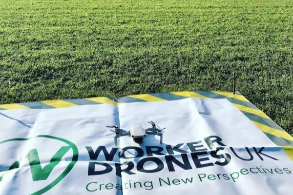
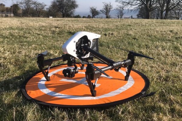
We are fully qualified drone (UAV) pilots with Permissions for Commercial Operations, issued by the Civil Aviation Authority. We also have public liability insurance for up to £10 million.
We have a wide and detailed understanding of both the public and private sectors and experience working with the manufacturing and leisure industries, advertising & marketing, the Environment Agency and the National Trust.
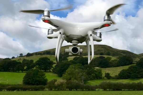
SEE YOUR WORK THROUGH OUR EYES EXPLORE THE OPPORTUNITIES WE HAVE TO OFFER Aerial photography provides a unique view of the world and in particular your project. From river restoration to examining solar panel farms and large scale building projects our photography helps keep you in the picture. Our drone pilots are fully qualified and CAA registered with a Permission for Commercial Operations (PfCO) and we hold public liability insurance for a maximum of £10 million, providing you with peace of mind.
No products were found matching your selection.
Services
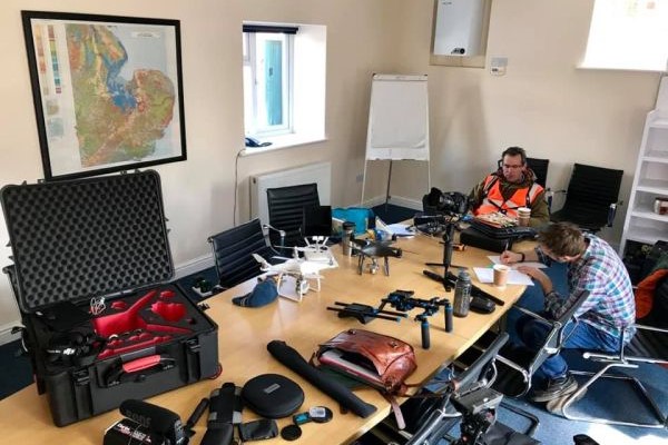
AERIAL VIDEO/PHOTOGRAPHY Fast, flexible, high quality & affordable aerial photography & video Our work is bespoke to our client and no two jobs are ever the same. We therefore structure our work based on your requirements and budget in order to tailor a product that is both affordable and meets your needs.
All our aerial work is carried out on site and we have a full suite of editing options available ranging from commercial advertising and event videos to high resolution photography.
The minimum time allowed for any project is 2 hours.
LAND, RIVER & BUILDING SURVEYS Aerial video-photography establishes a base line to track change
We can help you manage projects and review progress with the use of aerial photography and video. The use of vegetation and elevation filters can be used to highlight relevant features and the use of 3D aerial imaging can really bring your project to life.
3D MAPPING 3D Mapping to bring your project to life
We use aerial photography surveys and the latest in 3D modelling techniques to build computerised models of ancient monuments, buildings and other structures. THERMAL IMAGING Where heat matters
Thermal imaging can help to protect your assets by identifying issues early by reviewing the energy efficiency of your property and spotting overheating electrical components and mechanical hotspots etc.
Gallery
×
Manage Cookie Consent
To provide the best experiences, we and our partners use technologies like cookies to store and/or access device information. Consenting to these technologies will allow us and our partners to process personal data such as browsing behavior or unique IDs on this site and show (non-) personalized ads. Not consenting or withdrawing consent, may adversely affect certain features and functions.
Click below to consent to the above or make granular choices. Your choices will be applied to this site only. You can change your settings at any time, including withdrawing your consent, by using the toggles on the Cookie Policy, or by clicking on the manage consent button at the bottom of the screen.
Functional Always active
The technical storage or access is strictly necessary for the legitimate purpose of enabling the use of a specific service explicitly requested by the subscriber or user, or for the sole purpose of carrying out the transmission of a communication over an electronic communications network.
Preferences
The technical storage or access is necessary for the legitimate purpose of storing preferences that are not requested by the subscriber or user.
Statistics
The technical storage or access that is used exclusively for statistical purposes.The technical storage or access that is used exclusively for anonymous statistical purposes. Without a subpoena, voluntary compliance on the part of your Internet Service Provider, or additional records from a third party, information stored or retrieved for this purpose alone cannot usually be used to identify you.
Marketing
The technical storage or access is required to create user profiles to send advertising, or to track the user on a website or across several websites for similar marketing purposes.
To provide the best experiences, we use technologies like cookies to store and/or access device information. Consenting to these technologies will allow us to process data such as browsing behavior or unique IDs on this site. Not consenting or withdrawing consent, may adversely affect certain features and functions.
Functional Always active
The technical storage or access is strictly necessary for the legitimate purpose of enabling the use of a specific service explicitly requested by the subscriber or user, or for the sole purpose of carrying out the transmission of a communication over an electronic communications network.
Preferences
The technical storage or access is necessary for the legitimate purpose of storing preferences that are not requested by the subscriber or user.
Statistics
The technical storage or access that is used exclusively for statistical purposes.The technical storage or access that is used exclusively for anonymous statistical purposes. Without a subpoena, voluntary compliance on the part of your Internet Service Provider, or additional records from a third party, information stored or retrieved for this purpose alone cannot usually be used to identify you.
Marketing
The technical storage or access is required to create user profiles to send advertising, or to track the user on a website or across several websites for similar marketing purposes.
var wcpt_i18n = {"i18n_no_matching_variations_text":"Sorry, no products matched your selection. Please choose a different combination.","i18n_make_a_selection_text":"Please select some product options before adding this product to your cart.","i18n_unavailable_text":"Sorry, this product is unavailable. Please choose a different combination.","lang":""};
var wcpt_params = {"ajax_url":"https:\/\/avpay.aero\/wp-admin\/admin-ajax.php","wc_ajax_url":"\/?wc-ajax=%%endpoint%%","shop_url":"https:\/\/avpay.aero\/marketplace\/","shop_table_id":"82332","site_url":"https:\/\/avpay.aero","cart_widget_enabled_site_wide":"","cart_widget_exclude_urls":"","cart_widget_include_urls":"","initially_empty_cart":"1","initial_device":"laptop","breakpoints":{"tablet":"1199","phone":"749"},"price_decimals":"2","price_decimal_separator":".","price_thousand_separator":",","price_format":"%1$s%2$s","currency_symbol":"\u00a3","responsive_checkbox_trigger":"1"};
var wcpt_persist_params = ["s","post_type","term","taxonomy"];
var wcpt_ti_wishlist_url = "
https://avpay.aero/wishlist/";
var wcpt_ti_wishlist_ids = [];
var mejsL10n = {"language":"en","strings":{"mejs.download-file":"Download File","mejs.install-flash":"You are using a browser that does not have Flash player enabled or installed. Please turn on your Flash player plugin or download the latest version from https:\/\/get.adobe.com\/flashplayer\/","mejs.fullscreen":"Fullscreen","mejs.play":"Play","mejs.pause":"Pause","mejs.time-slider":"Time Slider","mejs.time-help-text":"Use Left\/Right Arrow keys to advance one second, Up\/Down arrows to advance ten seconds.","mejs.live-broadcast":"Live Broadcast","mejs.volume-help-text":"Use Up\/Down Arrow keys to increase or decrease volume.","mejs.unmute":"Unmute","mejs.mute":"Mute","mejs.volume-slider":"Volume Slider","mejs.video-player":"Video Player","mejs.audio-player":"Audio Player","mejs.captions-subtitles":"Captions\/Subtitles","mejs.captions-chapters":"Chapters","mejs.none":"None","mejs.afrikaans":"Afrikaans","mejs.albanian":"Albanian","mejs.arabic":"Arabic","mejs.belarusian":"Belarusian","mejs.bulgarian":"Bulgarian","mejs.catalan":"Catalan","mejs.chinese":"Chinese","mejs.chinese-simplified":"Chinese (Simplified)","mejs.chinese-traditional":"Chinese (Traditional)","mejs.croatian":"Croatian","mejs.czech":"Czech","mejs.danish":"Danish","mejs.dutch":"Dutch","mejs.english":"English","mejs.estonian":"Estonian","mejs.filipino":"Filipino","mejs.finnish":"Finnish","mejs.french":"French","mejs.galician":"Galician","mejs.german":"German","mejs.greek":"Greek","mejs.haitian-creole":"Haitian Creole","mejs.hebrew":"Hebrew","mejs.hindi":"Hindi","mejs.hungarian":"Hungarian","mejs.icelandic":"Icelandic","mejs.indonesian":"Indonesian","mejs.irish":"Irish","mejs.italian":"Italian","mejs.japanese":"Japanese","mejs.korean":"Korean","mejs.latvian":"Latvian","mejs.lithuanian":"Lithuanian","mejs.macedonian":"Macedonian","mejs.malay":"Malay","mejs.maltese":"Maltese","mejs.norwegian":"Norwegian","mejs.persian":"Persian","mejs.polish":"Polish","mejs.portuguese":"Portuguese","mejs.romanian":"Romanian","mejs.russian":"Russian","mejs.serbian":"Serbian","mejs.slovak":"Slovak","mejs.slovenian":"Slovenian","mejs.spanish":"Spanish","mejs.swahili":"Swahili","mejs.swedish":"Swedish","mejs.tagalog":"Tagalog","mejs.thai":"Thai","mejs.turkish":"Turkish","mejs.ukrainian":"Ukrainian","mejs.vietnamese":"Vietnamese","mejs.welsh":"Welsh","mejs.yiddish":"Yiddish"}};
var _wpmejsSettings = {"pluginPath":"\/wp-includes\/js\/mediaelement\/","classPrefix":"mejs-","stretching":"responsive","audioShortcodeLibrary":"mediaelement","videoShortcodeLibrary":"mediaelement"};
var wc_order_attribution = {"params":{"lifetime":1.0e-5,"session":30,"ajaxurl":"https:\/\/avpay.aero\/wp-admin\/admin-ajax.php","prefix":"wc_order_attribution_","allowTracking":false},"fields":{"source_type":"current.typ","referrer":"current_add.rf","utm_campaign":"current.cmp","utm_source":"current.src","utm_medium":"current.mdm","utm_content":"current.cnt","utm_id":"current.id","utm_term":"current.trm","session_entry":"current_add.ep","session_start_time":"current_add.fd","session_pages":"session.pgs","session_count":"udata.vst","user_agent":"udata.uag"}};
var woosc_vars = {"ajax_url":"https:\/\/avpay.aero\/wp-admin\/admin-ajax.php","nonce":"c428f65b43","hash":"oml3","user_id":"0cdb64fab32a05bd393b20c8c351de9f","page_url":"#","open_button":"","hide_empty_row":"yes","variations":"yes","open_button_action":"open_popup","menu_action":"open_popup","button_action":"show_table","sidebar_position":"right","message_position":"right-top","message_added":"{name} has been added to Compare list.","message_removed":"{name} has been removed from the Compare list.","message_exists":"{name} is already in the Compare list.","open_bar":"no","bar_bubble":"no","adding":"prepend","click_again":"no","hide_empty":"yes","click_outside":"yes","freeze_column":"yes","freeze_row":"yes","scrollbar":"yes","limit":"4","remove_all":"Do you want to remove all products from the compare?","limit_notice":"You can add a maximum of {limit} products to the comparison table.","copied_text":"Share link %s was copied to clipboard!","button_text":"Compare","button_text_added":"Compare","button_normal_icon":"woosc-icon-1","button_added_icon":"woosc-icon-74"};
var wc_cart_fragments_params = {"ajax_url":"\/wp-admin\/admin-ajax.php","wc_ajax_url":"\/?wc-ajax=%%endpoint%%","cart_hash_key":"wc_cart_hash_b6f0a4af5742f562436305e921d7ff3f","fragment_name":"wc_fragments_b6f0a4af5742f562436305e921d7ff3f","request_timeout":"5000"};
var tinvwl_add_to_wishlist = {"text_create":"Create New","text_already_in":"{product_name} already in Wishlist","simple_flow":"","hide_zero_counter":"","i18n_make_a_selection_text":"Please select some product options before adding this product to your wishlist.","tinvwl_break_submit":"No items or actions are selected.","tinvwl_clipboard":"Copied!","allow_parent_variable":"","block_ajax_wishlists_data":"","update_wishlists_data":"","hash_key":"ti_wishlist_data_b6f0a4af5742f562436305e921d7ff3f","nonce":"6c227abb2d","rest_root":"https:\/\/avpay.aero\/wp-json\/","plugin_url":"https:\/\/avpay.aero\/wp-content\/plugins\/ti-woocommerce-wishlist\/","wc_ajax_url":"\/?wc-ajax=tinvwl","stats":"","popup_timer":"6000"};
var wcfm_datepicker_params = {"closeText":"Done","currentText":"Today","monthNames":["January","February","March","April","May","June","July","August","September","October","November","December"],"monthNamesShort":["Jan","Feb","Mar","Apr","May","Jun","Jul","Aug","Sep","Oct","Nov","Dec"],"monthStatus":"Show a different month","dayNames":["Sunday","Monday","Tuesday","Wednesday","Thursday","Friday","Saturday"],"dayNamesShort":["Sun","Mon","Tue","Wed","Thu","Fri","Sat"],"dayNamesMin":["S","M","T","W","T","F","S"],"dateFormat":"MM dd, yy","firstDay":"1","isRTL":""};
var wcfm_datepicker_params = {"closeText":"Done","currentText":"Today","monthNames":["January","February","March","April","May","June","July","August","September","October","November","December"],"monthNamesShort":["Jan","Feb","Mar","Apr","May","Jun","Jul","Aug","Sep","Oct","Nov","Dec"],"monthStatus":"Show a different month","dayNames":["Sunday","Monday","Tuesday","Wednesday","Thursday","Friday","Saturday"],"dayNamesShort":["Sun","Mon","Tue","Wed","Thu","Fri","Sat"],"dayNamesMin":["S","M","T","W","T","F","S"],"dateFormat":"MM dd, yy","firstDay":"1","isRTL":""};
var wcfm_core_dashboard_messages = {"product_approve_confirm":"Are you sure and want to approve \/ publish this 'Product'?","product_reject_confirm":"Are you sure and want to reject this 'Product'?\nReason:","product_archive_confirm":"Are you sure and want to archive this 'Product'?","multiblock_delete_confirm":"Are you sure and want to delete this 'Block'?\nYou can't undo this action ...","article_delete_confirm":"Are you sure and want to delete this 'Article'?\nYou can't undo this action ...","product_delete_confirm":"Are you sure and want to delete this 'Product'?\nYou can't undo this action ...","message_delete_confirm":"Are you sure and want to delete this 'Message'?\nYou can't undo this action ...","order_delete_confirm":"Are you sure and want to delete this 'Order'?\nYou can't undo this action ...","enquiry_delete_confirm":"Are you sure and want to delete this 'Enquiry'?\nYou can't undo this action ...","support_delete_confirm":"Are you sure and want to delete this 'Support Ticket'?\nYou can't undo this action ...","follower_delete_confirm":"Are you sure and want to delete this 'Follower'?\nYou can't undo this action ...","following_delete_confirm":"Are you sure and want to delete this 'Following'?\nYou can't undo this action ...","resource_delete_confirm":"Are you sure and want to delete this 'Resource'?\nYou can't undo this action ...","auction_bid_delete_confirm":"Are you sure and want to delete this 'Bid'?\nYou can't undo this action ...","order_mark_complete_confirm":"Are you sure and want to 'Mark as Complete' this Order?","booking_mark_complete_confirm":"Are you sure and want to 'Mark as Confirmed' this Booking?","booking_mark_decline_confirm":"Are you sure and want to 'Mark as Declined' this Booking?","appointment_mark_complete_confirm":"Are you sure and want to 'Mark as Complete' this Appointment?","add_new":"Add New","select_all":"Select all","select_none":"Select none","any_attribute":"Any","add_attribute_term":"Enter a name for the new attribute term:","wcfmu_upgrade_notice":"Please upgrade your WC Frontend Manager to Ultimate version and avail this feature.","pdf_invoice_upgrade_notice":"Install WC Frontend Manager Ultimate and WooCommerce PDF Invoices & Packing Slips to avail this feature.","wcfm_bulk_action_no_option":"Please select some element first!!","wcfm_bulk_action_confirm":"Are you sure and want to do this?\nYou can't undo this action ...","review_status_update_confirm":"Are you sure and want to do this?","everywhere":"Everywhere Else","required_message":"This field is required.","choose_select2":"Choose ","category_attribute_mapping":"All Attributes","search_page_select2":"Search for a page ...","search_attribute_select2":"Search for an attribute ...","search_product_select2":"Filter by product ...","search_taxonomy_select2":"Filter by category ...","choose_category_select2":"Choose Categories ...","choose_listings_select2":"Choose Listings ...","choose_tags_select2":"Choose Tags ...","choose_vendor_select2":"Choose Company ...","no_category_select2":"No categories","select2_searching":"Searching ...","select2_no_result":"No matching result found.","select2_loading_more":"Loading ...","select2_minimum_input":"Minimum input character ","wcfm_product_popup_next":"Next","wcfm_product_popup_previous":"Previous","wcfm_multiblick_addnew_help":"Add New Block","wcfm_multiblick_remove_help":"Remove Block","wcfm_multiblick_collapse_help":"Toggle Block","wcfm_multiblick_sortable_help":"Drag to re-arrange blocks","sell_this_item_confirm":"Do you want to add this item(s) to your store?","bulk_no_itm_selected":"Please select some product first!","user_non_logged_in":"Please login to the site first!","shiping_method_not_selected":"Please select a shipping method","shiping_method_not_found":"Shipping method not found","shiping_zone_not_found":"Shipping zone not found","shipping_method_del_confirm":"Are you sure you want to delete this 'Shipping Method'?\nYou can't undo this action ...","variation_auto_generate_confirm":"Are you sure you want to link all variations? This will create a new variation for each and every possible combination of variation attributes (max 50 per run)."};
var wcfm_params = {"ajax_url":"\/wp-admin\/admin-ajax.php","wc_ajax_url":"\/wp-admin\/admin-ajax.php","shop_url":"https:\/\/avpay.aero\/marketplace\/","wcfm_is_allow_wcfm":"","wcfm_is_vendor":"","is_user_logged_in":"","wcfm_allow_tinymce_options":"undo redo | insert | styleselect | bold italic | alignleft aligncenter alignright alignjustify | bullist numlist outdent indent | link image | ltr rtl","unread_message":"0","unread_enquiry":"0","wcfm_is_allow_new_message_check":"1","wcfm_new_message_check_duration":"300000","wcfm_is_desktop_notification":"1","is_mobile_desktop_notification":"","wcfm_is_allow_external_product_analytics":"","is_mobile":"","is_tablet":"","wcfm_ajax_nonce":"056002f698"};
var wcfm_enquiry_manage_messages = {"no_name":"Name is required.","no_email":"Email is required.","no_enquiry":"Please insert your Enquiry before submit.","no_reply":"Please insert your reply before submit.","enquiry_saved":"Your Enquiry successfully sent.","enquiry_published":"Enquiry reply successfully published.","enquiry_reply_saved":"Your reply successfully sent."};
var wcfmu_products_manage_messages = {"no_title":"Please insert Product Title before submit.","no_excerpt":"Please insert Product Short Description before submit.","no_description":"Please insert Product Description before submit.","sku_unique":"Product SKU must be unique.","variation_sku_unique":"Variation SKU must be unique.","product_saved":"Product Successfully Saved.","product_pending":"Product Successfully submitted for moderation.","product_published":"Product Successfully Published.","set_stock":"Set Stock","increase_stock":"Increase Stock","regular_price":"Regular Price","regular_price_increase":"Regular price increase by","regular_price_decrease":"Regular price decrease by","sales_price":"Sale Price","sales_price_increase":"Sale price increase by","sales_price_decrease":"Sale price decrease by","length":"Length","width":"Width","height":"Height","weight":"Weight","download_limit":"Download Limit","download_expiry":"Download Expiry"};
var wcfm_reviews_messages = {"no_comment":"Please insert your comment before submit.","no_rating":"Please rate atleast one category before submit.","review_saved":"Your review successfully submited, will publish after approval!","review_published":"Your review successfully submited.","review_response_saved":"Your review response successfully submited.","refund_requests_failed":"Your refund request failed, please try after sometime.","refund_requests_approved":"Refund requests successfully approved."};
var wcfm_slider_banner_delay = {"delay":"4000"};
var wcfmmp_store_map_options = {"default_lat":"53.5616654","default_lng":"-2.327565","default_zoom":"10","store_icon":"https:\/\/avpay.aero\/wp-content\/plugins\/wc-multivendor-marketplace\/assets\/images\/wcfmmp_map_icon.png","icon_width":"40","icon_height":"57","is_poi":"1","is_allow_scroll_zoom":"1","is_rtl":""};
let cmplzBlockedContent = document.querySelector('.cmplz-blocked-content-notice');
if ( cmplzBlockedContent) {
cmplzBlockedContent.addEventListener('click', function(event) {
event.stopPropagation();
});
}
var wcpa_front = {"api_nonce":null,"root":"https:\/\/avpay.aero\/wp-json\/wcpa\/front\/","assets_url":"https:\/\/avpay.aero\/wp-content\/plugins\/woo-custom-product-addons-pro\/assets\/","date_format":"F j, Y","time_format":"H:i","validation_messages":{"uploadPending":"Files are being uploaded.","validNumberError":"Provide a valid number.","formError":"Fix the errors shown above","checkCaptcha":"Tick the \"I'm not a robot\" verification","requiredError":"Field is required","allowedCharsError":"Characters %s is not supported","patternError":"Pattern not matching","minlengthError":"Minimum %s characters required","maxlengthError":"Maximum %s characters allowed","minValueError":"Minimum value is %s","maxValueError":"Maximum value is %s","minFieldsError":"Select minimum %s fields","maxFieldsError":"Select maximum %s fields","maxFileCountError":"Maximum %s files allowed","minFileCountError":"Minimum %s files required","maxFileSizeError":"Maximum file size should be %s","minFileSizeError":"Minimum file size should be %s","fileExtensionError":"File type is not supported","quantityRequiredError":"Please enter a valid quantity","otherFieldError":"Other value required","charleftMessage":"%s characters left","validEmailError":"Provide a valid email address","validUrlError":"Provide a valid URL","minQuantityError":"Minimum quantity required is %s","maxQuantityError":"Maximum quantity allowed is %s","groupMinError":"Requires minimum %s","groupMaxError":"Allowed maximum %s","uploadError":"Failed to upload %s","gt_translate_keys":["uploadPending","validNumberError","formError","checkCaptcha","requiredError","allowedCharsError","patternError","minlengthError","maxlengthError","minValueError","maxValueError","minFieldsError","maxFieldsError","maxFileCountError","minFileCountError","maxFileSizeError","minFileSizeError","fileExtensionError","quantityRequiredError","otherFieldError","charleftMessage","validEmailError","validUrlError","minQuantityError","maxQuantityError","groupMinError","groupMaxError","uploadError"]},"google_map_api":"","reCAPTCHA_site_key":"","recaptcha_v":"v2","ajax_add_to_cart":"","summary_order":["option_price","product_price","fee","discount","total_price"],"change_price_as_quantity":"1","show_field_price_x_quantity":"","disable_validation_scroll":"","gallery_update_field":"last_field","update_top_price":"","datepicker_disableMobile":"","radio_unselect_img":"","strings":{"place_selector_street":"Street Address","place_selector_city":"City","place_selector_state":"State","place_selector_zip":"Zip Code","place_selector_country":"Country","place_selector_latitude":"Latitude","place_selector_longitude":"Longitude","file_button_text":"Choose File","file_placeholder":"{count} Files","file_droppable_action_text":"Browse","file_droppable_desc_text":"or {action} to choose a file","file_upload_completed":"Completed","file_upload_failed":"Failed to upload","other":"Other","clearSelection":"Clear Selection","repeater_add":"Add Field","repeater_remove":"Remove Field","file_droppable_text":"Drag and Drop Files Here","to":" to ","gt_translate_keys":["place_selector_street","place_selector_city","place_selector_state","place_selector_zip","place_selector_country","place_selector_latitude","place_selector_longitude","file_button_text","file_placeholder","file_droppable_action_text","file_droppable_desc_text","file_upload_completed","file_upload_failed","other","clearSelection","repeater_add","repeater_remove","file_droppable_text","to"]},"i18n_view_cart":"View cart","options_price_format":"(price)","wc_price_format":"%1$s%2$s","hide_option_price_zero":"1","discount_show_field_price":"1","discount_strike_field_price":"1","discount_strike_summary_price":"1","discount_strike_total_price":"1","responsive_layout":"","product_price_parent_selector":".summary","accordion_open":"first_opened","accordion_auto_open":"","accordion_auto_close":"","woo_price_suffix":"","prices_include_tax":"1","isAdmin":"","cart_url":"https:\/\/avpay.aero\/cart-2\/","is_cart":"","user_roles":["guest"],"google_map_countries":"","init_triggers":["wcpt_product_modal_ready","qv_loader_stop","quick_view_pro:load","elementor\/popup\/show","xt_wooqv-product-loaded","woodmart-quick-view-displayed","porto_init_countdown","woopack.quickview.ajaxload","quick-view-displayed","update_lazyload","riode_load","yith_infs_added_elem","jet-popup\/show-event\/after-show","etheme_quick_view_content_loaded","wc_backbone_modal_loaded"],"wc_currency_symbol":"\u00a3","wc_currency_symbol_raw":"\u00a3","wc_thousand_sep":",","wc_price_decimals":"2","price_format":"%1$s%2$s","wc_decimal_sep":".","wc_currency_pos":"left","mc_unit":"1","addons":[],"upload_method":"normal"};