Founded in 2016, Epic Air Aerial Services is a Fully Licensed & Insured Drone Operator (South African Civil Aviation Authority (SACAA) ROC Nr: G1336D) offering UAV (Unmanned Aerial Vehicle) solutions for your projects and operational needs. We specialise in aerial services ranging from industrial applications to agriculture management. Our aerial drone services and aerial photography services provide the drone capabilities you require. We are a passionate aerial service company offering highest quality aerial media services to a wide range of industries including aerial inspections and real estate that require UAV aerial services.
We provide top quality RPAS (Remotely Piloted Aircraft System) aerial drone photography services and solutions with speed, efficiency and with safety as our priority. We are an enthusiastic, commercial drone operator company based in Cape Town and offer competitive rates throughout South Africa and abroad.
Services
Drones for Agriculture and Farming
Precision agriculture is a farming management concept that uses drone to measure, observe and act on changes in crops.
Achieve significant improvements in crop yields with the use of drones. Regular aerial monitoring of agricultural lands can provide us with a more in depth analysis of crop performance.
-Crop scout sections of farmland
-Identify soil and crop issues with NDVI, VARI, and measure plant health instantly
-Take field action and monitor reports over time
-Drive down costs and increase profits by avoiding crop loss by rapid intervention. Minimize crop loss and boost yield.
Film and Media Drone Services
Drones bring flexibility to the table to achieve almost any shot from anywhere producing high-quality images and with its manoeuvrability able to track moving objects while filming dynamic action shots whether its chasing objects or panning.
Utilising drones for camera movement in the film industry and events to produce beautiful footage that is rapidly becoming a necessity for quality productions. This extends into feature films, television, commercials, music videos, social media content, digital marketing, stock footage and sports events.
At Epic Air we understand and are experienced in the highly stressed environment that comes with the film, television and event industries and with a brief from you we can produce shot changing content and footage to take your production or event to new heights.
While focusing on the footage, we also maintain a high level of safety throughout our flights and our professional and approachable team will propel your project into the aerial world with style.
In order for Licensed Operators to film in CBD’s, urban areas, National Parks, next to Roads, People, Buildings and at events, the following permits and permissions are required if necessary depending on the locations and client specs.
Disaster Risk Management Approval
San Parks permission (National Park Approval)
CAA Approval
Film office permit if flight is for a shoot
Insurance
Drone registration certificate from the CAA
RLA Certificate for drone from the CAA
Department of Transport License
Qualified and licensed pilot with valid RPL and medical certificate
All operations staff need a Dangerous Goods certificate
All operations staff need an aviation security certificate
All operations staff have background checks and valid police clearance certificates (13.Valid ROC)
Some common aerial shots from drones for filming:
• Bird’s eye of subject – above subject looking down
• Overtake subject shot – flying over subject
• Subject moving into shot
• Tilt reveal shot, establishing shots
• Crane simulations shot – flying from ground level straight up
• Moving subject shot – tracking cars, bikes, boats, runners, cyclist and animals
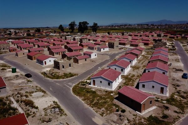
Real Estate Drone Photography
Producing dramatic, sweeping shots of landscapes, ocean and mountain vistas and seamless fly-arounds of gorgeous home exteriors… taking shots of homes never before imagined.
Aside from shooting cool videos of expensive oceanfront homes, drones can also help with a myriad of dull but necessary real estate related jobs, including:
-property appraisals
-home inspections
-documenting hurricane and fire damage
-monitoring land erosion
-documenting property lines and
-visioning and master planning
Also, using special software, we are able to create finely-grained 3D models of buildings and landscapes. These tools may one day help real estate developers make better use of limited resources and design homes to fit more naturally in a particular environment.
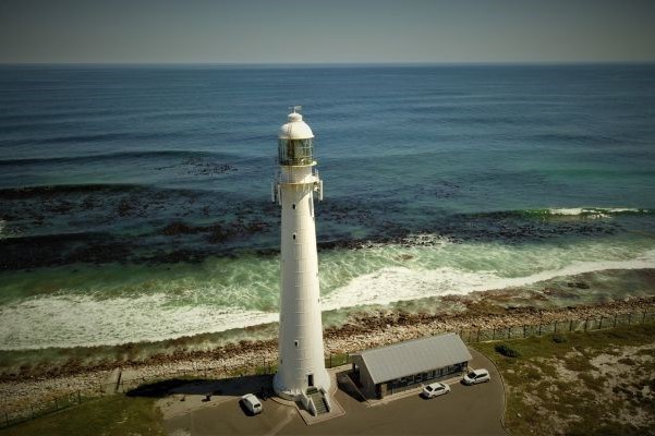
UAV Aerial Inspections
Whether you’re inspecting a new building, tower, crane etc or investigating an insurance claim, it’s important to capture accurate data quickly. Drones are a powerful new tool for inspection; – allowing you to safely and easily capture a high-resolution aerial view of a site in minutes.
Back in the office, or out in the field, it’s easy to analyze high-fidelity reconstructions of sites, make measurements and share comments to help you make better and faster decisions. UAV’s have the ability to enhance worker safety, reduce fatigue and increase productivity, while facilitating such important work as tower inspections and pre-climb hazard assessments.
UAV’s achieve this by having:
-The ability to more quickly identify and verify tower equipment specifications and damage
-The reduction for the need of workers to climb towers to perform routine audits and inspections
Power lines, Cell towers, Oil and gas pipelines, Railways, Methane detection; – all of these and so many other types of industrial inspection are made easier, safer, and more efficient with drones/UAV’s or unmanned aerial systems.
Large, complex structures are best surveyed from the air. It’s no wonder that inspections has been one of the first UAV applications to be quickly and widely embraced world-wide.
ACCURATE, SAFE AERIAL INSPECTIONS IN MINUTES
UAVs are revolutionizing the inspection industry. Below are just a few of the inspection types users complete with drones/uav’s:
• OIL PIPELINE INSPECTION
• GAS PIPELINE INSPECTIONS
• METHANE GAS INSPECTIONS
• SOLAR PANEL INSPECTIONS
• POWER LINE / CABLE INSPECTIONS
• COOLING TOWER INSPECTIONS
• CRITICAL INFRASTRUCTURE INSPECTIONS
• WIND TURBINE / WINDMILL / WIND FARM INSPECTIONS
• RAILWAY / TRAIN LINE INSPECTIONS
• BRIDGE INSPECTIONS
• MONUMENT INSPECTIONS
• RADIATION MEASUREMENT AND MONITORING
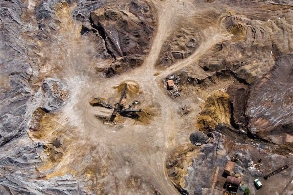
• MINING INSPECTIONS
• ROOF INSPECTIONS
• INDUSTRIAL EQUIPMENT INSPECTIONS
• WEATHER DAMAGE INSPECTIONS
• CONSTRUCTION SITE INSPECTIONS
WIND TURBINE / WINDMILL / WIND FARM INSPECTIONS
Traditionally, wind turbines are inspected by Rope Access technicians and ground-based cameras. Climbing towers are dangerous. In 2016 the UK reported 163 accidents and 5 fatalities in the wind turbine industry. Even though Rope Access technicians are trained and follow strict safety standards, accidents happen. Pilots in aviation follow the “IMSAFE” rule to avoid flying when not physically and mentally fit to affectively do the job. IMSAFE translates into illness, medication, stress, alcohol /drugs, fatigue and emotions. Rope Access crew and pilots at times are probably affected by this while inspecting a turbine, the difference is incidents and accidents are a lot more severe with Rope Access Crew compared to the drone pilots.
Using machines radically reduces the chances of injury or death caused by human error. Bottom line, safety is massively increased from making decisions hanging from a rope compared to having feet safely on the ground.
Depending on the terrain, Drone/UAV teams can inspect between 8 to 10 turbines per day. On average approximately 40 mins per turbine if all goes well. This drastically reduces costs and inspection times compared to rope access crew. After the captured data is reviewed by the pilots it is uploaded to online wind turbine inspection software. The data is stored properly, organized, secured, is easy to use and this enables asset managers, developers, maintenance technicians and insurance adjusters to analyze defects and damage. They are also able to reference the data to track changes over time or compare data after repairs have been conducted.
With drone/uav wind turbine inspections there are manual and automated inspections. Manual inspections the missions are flown by skilled pilots. The drones are flown up and down the blades capturing the images while keeping safe separation between the drone and the blade. Automatic drone inspections the missions are pre-loaded for flights, flown by software and guided by lidar sensors. Automatic inspections are a lot more expensive because of the equipment and technology required to do the job.
Wind Turbines operate in harsh weather. Wear and tear on the blades can be caused by extreme temperatures, gritty sand, high winds, ultraviolet radiation, freezing rain, sleet and saltwater.
Types of issues that can be detected:
• Leading edge erosion
• Lightning strike damage
• Small cracks or splits along the bond joints
• Foreign object damage
• Very small cracks and light wear (that can’t be seen by scope)
• UV radiation damage
• Fiber waves
• Pitch errors
• Gel coat degradation
• Impact damage
• Potentially catastrophic delamination
• Debonding
• Longitudinal/travers cracking
• Dry Fibers
• Charring
• Chordwise cracking
• Pitting
• Spider Cracks
• Flagging
• Holes
• Crazing
• Crush
• Top coat flaking
• Repair failures
Drones can also be used across the whole lifecycle of the wind turbine for example:
• Property scouting and selecting the appropriate site by mapping the proposed areas.
• Create digital elevation and surface models for site planning and management
• Periodically survey sites for progress monitoring of the installations
• Inspect turbines to ensure components are ready for energy production
• Building maps for decommissioning planning
SOLAR FARM SOLAR PANEL INSPECTIONS
Malfunctioning faulty solar panels can cause daily losses to energy output. Over time this results in revenue losses if not detected. The objection of drone/UAV inspections is to minimise downtime and to increase performance and reduce costs over time. Drones can be used to inspect the solar panels for defects and damage or it can be used for progress report during the construction phase of the solar farm. The captured data is uploaded into artificial-intelligence software that analyzes the imagery.
The inspection data can also be used for:
• Commissioning
• Storm damage analysis
• Submit warranty claims
• Insurance adjusters able to analyze
• Progress reporting on construction of solar farms
• Pre-site mapping for planning of the construction of the solar farms
• Valuations for asset transfers
As with mapping software the process of doing a mission inspection on a solar farm with drones are the same. The drones have pre-programmed flight plans loaded on solar inspection software. The flights are automated flights on the day of the inspection. After the mission is flown, the images/data from the drone are uploaded in the solar inspection software.
There are two main reports that the solar inspection software can deliver.
Construction progress reporting:
• 2D orthomosaic – HD Map of area
• Analytics on project status
• Earth moving that is required
• Snapshot of the stage the construction site is at
• Digital terrain models
• Elevation maps
• CAD Files
• Excell files
• PDF Files
The benefits of progress reporting is to ensure deadlines are met by identifying problems before they occur during every stage of the project.
Solar panel health reporting:
• Identify underperforming panels and the anomalies that are causing it.
• Show cold areas of non-functioning panels
• Detect hot spots or overheating panels
• Pick up damaged or cracked panels
• Track trends over time
ROOF INSPECTIONS
How exactly are drones used for roof inspections?
Roof inspections are done by piloting a drone with a high-resolution camera and capturing multiple images of the roof.
The most common methods are manual and automated inspections.
With manual inspections high-resolution images are captured by the pilot flying the drone. This enables real close up images to be captured of inaccessible areas and steep angles. This method is used to get a rough overview of the roof before deciding on the next step to take with the inspection. The images can be reviewed on-site or back at the office. This method also allows for multiple inspections in a day.
Automated inspections are done by a process called photogrammetry. The drone conducts an automated flight and captures multiple images. These images are uploaded into a Cloud based drone data platform. By stitching all the images, the cloud based platform creates 3D models and or 2D Orthomosaic maps of the roof. With the end product it is possible to calculate length, area, angles and volumes of the inspected roof.
Thermal cameras are also used with drone roof inspections. With the captured thermal images it is possible to detect leaks by picking up heat differences on the roof. Wet areas retain heat for longer periods than dry areas.
Drones eliminate risk for inspectors by preventing the following:
• Falling from climbing up the side of a building with a ladder or scaffolding,
• Causing damage of and/or the collapse of roofs from walking and weight on the roof
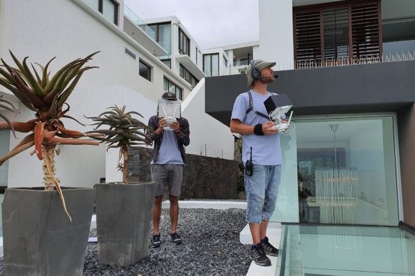
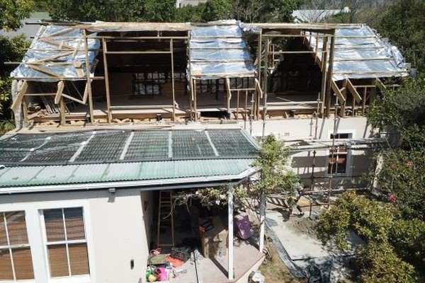
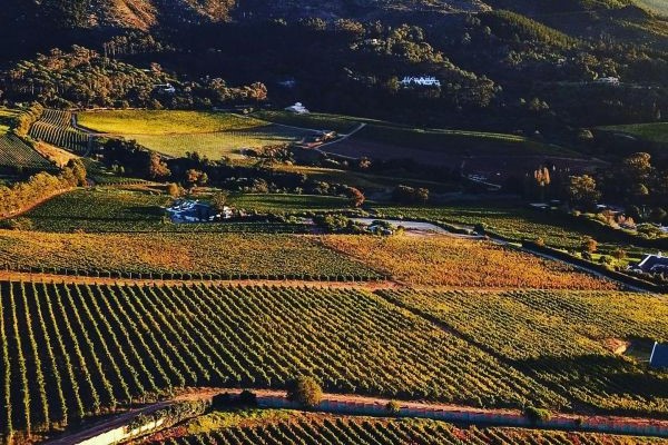
Gallery