At Esprit Drone Services we offer aerial surveying, videography & photography. We are unique in that our background and experience is decades of video production, photography and also manned flying. This means we can service your media requirements end-to-end with both ground and aerial footage and video production/editing.
Working between 0 and 120m/400ft we can capture unique views without the expense of a helicopter or crane and in a much safer environment and without the access problems traditional methods suffer from.
Quicker, safer, cheaper are our goals with all of our clients.
All work carried out is carried out with RAMS and PLI in place and in accordance with CAA PfCO (UAS-6599) requirements. Pre-flight surveys and risk assessments take the guessing out of safety which is our number one priority for our operations.
With our rapid post-production workflow, we can turn around your job at the pace you require, ensuring you get the media you need in the minimum of time.
Rest assured of a professional service from the first call.
Services
Experienced, Creative & Reliable
At Esprit Drone Services we offer aerial surveying, videography & photography. We are unique in that our background and experience is decades of video production, photography and also manned flying. This means we can service your media requirements end-to-end with both ground and aerial footage and video production/editing.
Working between 0 and 120m/400ft we can capture unique views without the expense of a helicopter or crane and in a much safer environment and without the access problems traditional methods suffer from.
Quicker, safer, cheaper are our goals with all of our clients.
All work carried out is carried out with RAMS and PLI in place and in accordance with CAA PfCO (UAS-6599) requirements. Pre-flight surveys and risk assessments take the guessing out of safety which is our number one priority for our operations.
With our rapid post-production workflow, we can turn around your job at the pace you require, ensuring you get the media you need in the minimum of time.
Aerial & Ground Videography
With an extensive background in media production for a variety of industries we can enhance your brand or production with a full suite of video production facilities.
Using our 4k UHD aerial cameras we can capture unique views which when either used standalone or combined with ground footage can offer you the media you require from end-to-end.
Our ground based equipment complements the drones with 4K UHD capture using Sony FS5/FS7 cameras and a large compliment of audio and lighting accessories as required.
We are also very experienced video editors and can produce every aspect of the media you need for your business.
Live Streaming
Esprit Drone Services also offer a range of live streaming services.
We can of course live stream from our aerial platforms but have worked with a large number of companies and world famous musicians and bands to showcase their company, brand or music to huge audiences.
Using the very latest in streaming technology, we can offer public and private streams available via internal methods or social media such as Facebook, Youtube & Twitter.
Aerial Surveying and Inspection
Fast, efficient and safe surveying & inspection
Surveying is usually an expensive, labour and equipment intense task. We can eliminate the need for much of this with our aerial surveying and inspection services. With full RAMS in place and PLI, we can negate the need for expensive scaffolding and other working at height equipment, not only removing the risk to workers but also saving often huge costs involved with such operations.
For agriculture, structural, construction and roof inspection services we can offer photogrammetry with detailed 2D/3D/Elevation/Measurements (3D and Volumetric) and even plant health from the air.
If you are looking for very detailed imagery or video for inspection purposes, we can produce 4K UHD video or 20mp 300DPI images with our fleet of drones.
Drones in Construction for Marketing, Inspection & Surveying
Elevate your business to new heights
Construction and building companies are more and more turning to drones to add value to their projects. Offering a large range of benefits, we work with a number of high profile clients to offer aerial photography, videography and surveying. Offering a full end-to-end service, our work can enhance your marketing efforts with amazing views of your sites from above and we also use our equipment to offer incredibly accurate surveying coupled with traditional GNSS methods.
With the latest DJI Unmanned Aerial Systems we can shoot video in HD or 4k UHD and produce 300 DPI print quality imagery. With 20+ years photography and videography experience, our drones are another dimension added to our camera work and we also shoot architectural and ground based video and stills. All work can be provided as RAW images or video rushes but more normally we offer full edit facilities and can produce pictures and videos ready to go!
Drone Roof Surveys & Inspection
Fast, efficient and safe roof surveying & inspection
Traditional roof surveys methods can be time-consuming, expensive and also dangerous for those involved. Using our state of the art Unmanned Aerial Systems we can survey both domestic and industrial roofs much quicker, safer and collect high-resolution imagery and video providing and instant and permanent record.
With full RAMS in place and PLI, we can negate the need for expensive scaffolding and other working at height equipment, not only removing the risk to workers but also saving often huge costs involved with such operations.
If you are looking for very detailed imagery or video for inspection purposes, we can produce 4K UHD video or 20mp 300DPI images with our fleet of drones.
Aerial & Ground Caravan Park Surveys
Fast, efficient and safe caravan park surveying
Traditional surveying methods can be time-consuming and expensive. Using our state of the art Unmanned Aerial Systems we can survey caravan parks to produce incredibly accurate CAD drawings and plans to aid your operations.
With full RAMS in place and PLI, safety is key and we also provide a very quick turnaround with our surveying partner organisations. We can produce 2D & 3D topographical surveys, inspection surveys, thermal and multispectral, 360 panoramics, LiDAR as well as video and imagery. Our aerial surveys are backed up with qualified GNSS data for maximum accuracy of the delivered product to you.
If you are looking for very detailed imagery or video for inspection purposes, we can produce 4K UHD video or 20mp 300DPI images with our fleet of drones.
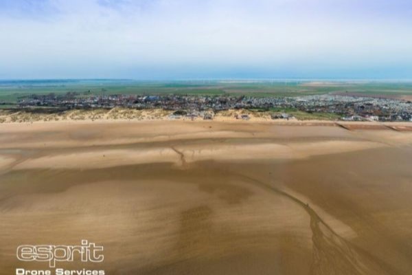
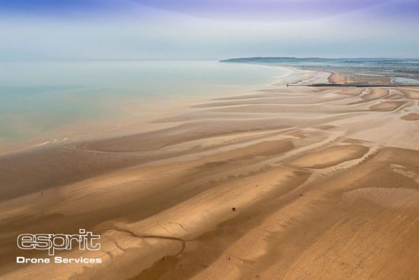
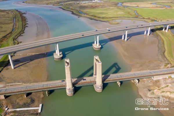
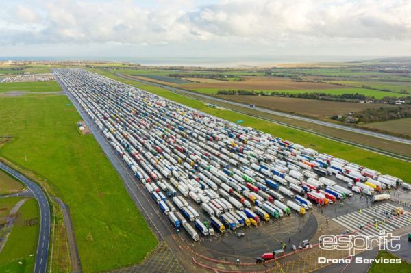
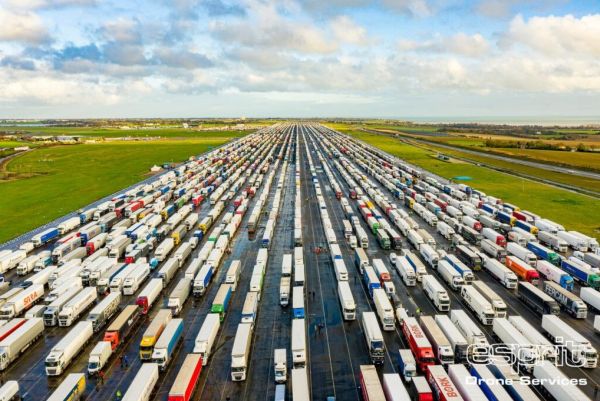
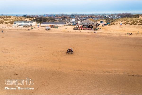
Gallery